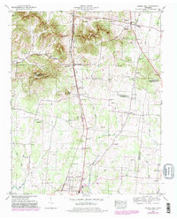
1949 Map of Chapel Hill
USGS Topo · Published 1981About this map
Riggs Crossroads and the surrounding farmland sit at a geographic intersection where Marshall, Williamson, and Rutherford counties meet. This 1949 survey, with revisions through the late 1970s, captures a landscape defined by small rural hubs and the Louisville and Nashville railroad corridor. The terrain transitions from the elevations of the Tennessee Valley Divide and Buckeye Ridge in the north toward the flatter basins of Lick Creek and Plum Branch in the south.
Find a feature on this map
65 named features on this map. Tap any name to fly to it.
Don’t see what you’re looking for? This feature index may not catch every label — zoom into the map to look around manually.
Map Details
Editions of this 1949 Chapel Hill Map
2 editions found
Other maps of this area

1909 · Franklin
USGS Topo · 1:62,500

1936 · Chapel Hill
USGS Topo · 1:24,000

1936 · Farmington
USGS Topo · 1:24,000

1936 · Rover
USGS Topo · 1:24,000

1936 · Verona
USGS Topo · 1:24,000

1936 · Rally Hill
USGS Topo · 1:24,000

1936 · Unionville
USGS Topo · 1:24,000

1936 · Bethesda
USGS Topo · 1:24,000

1942 · Lebanon
USGS Topo · 1:100,000

1944 · Shelbyville
USGS Topo · 1:100,000