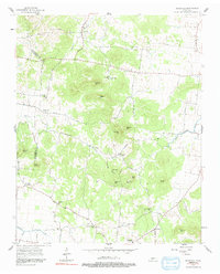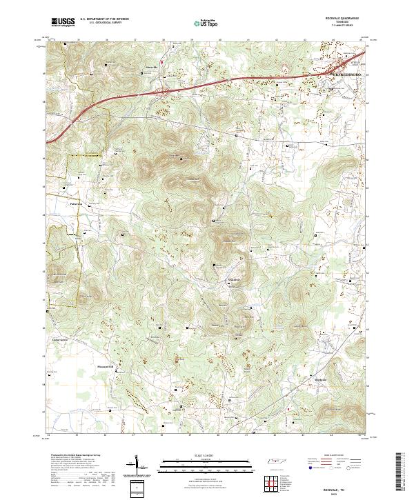
2022 Map of Rockvale
USGS Topo · Published 2022About this map
The rolling limestone landscape of Rutherford and Williamson counties is defined by a complex network of springs and family cemeteries. Significant hydrological features like Blue Sink and the Snail Shell Cave Spring underscore the area's karst geology, while the headwaters of the Harpeth River and Overall Creek drain the surrounding hills. This contemporary survey captures the transition from historic rural settlements to suburban expansion, particularly near Murfreesboro and the Interstate 840 corridor.
Find a feature on this map
148 named features on this map. Tap any name to fly to it.
Don’t see what you’re looking for? This feature index may not catch every label — zoom into the map to look around manually.
Map Details
Editions of this 2022 Rockvale Map
This is the sole edition of this map. No revisions or reprints were ever made.