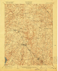
1908 Map of Rockville
USGS Topo · Published 1918About this map
Rockville and Gaithersburg serve as the primary hubs in this early twentieth-century survey of Montgomery County, Maryland. The landscape is defined by a dense network of country roads and historical turnpikes, including the Union Turnpike and Frederick Road, which connect a series of established rural settlements like Laytonsville, Sandy Spring, and Brookeville. The Baltimore and Ohio Railroad (Metropolitan Branch) cuts diagonally through the territory, marking the growth of commuter and industrial corridors at places like Derwood and Washington Grove. To the southwest, the Potomac River forms a dramatic boundary at Great Falls, while the northeastern portion shows the Patuxent River bordering the now-submerged site of Triadelphia. This map captures the region when it was still characterized by scattered schools like the Academy, family-named branches, and a distinct agrarian social structure before the mid-century expansion of the capital region.
Find a feature on this map
79 named features on this map. Tap any name to fly to it.
Don’t see what you’re looking for? This feature index may not catch every label — zoom into the map to look around manually.
Map Details
Editions of this 1908 Rockville Map
3 editions found

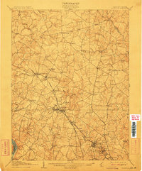
Other maps of this area

1890 · Mt. Vernon
USGS Topo · 1:125,000

1891 · Mt. Vernon
USGS Topo · 1:125,000

1892 · Laurel
USGS Topo · 1:62,500

1892 · Ellicott
USGS Topo · 1:62,500

1893 · Frederick
USGS Topo · 1:125,000

1894 · Ellicott
USGS Topo · 1:62,500

1894 · Laurel
USGS Topo · 1:62,500

1894 · Frederick
USGS Topo · 1:125,000

1894 · Mt. Vernon
USGS Topo · 1:125,000

1897 · Laurel
USGS Topo · 1:62,500