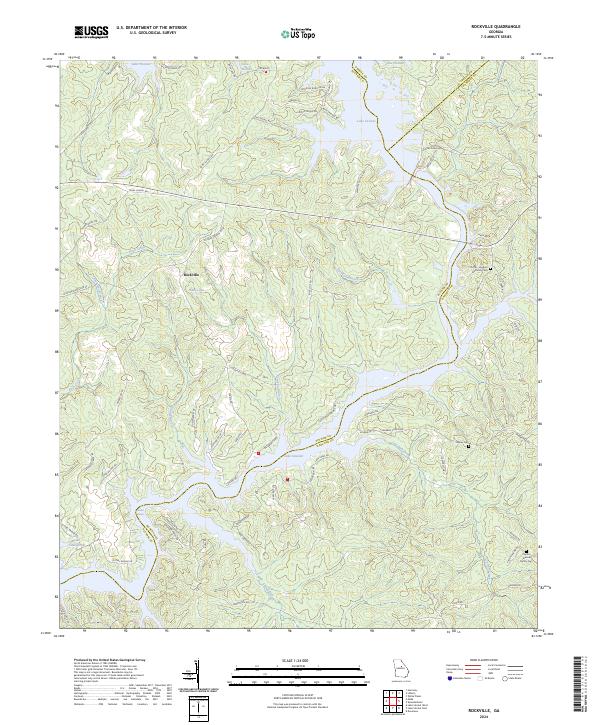
2024 Map of Rockville
USGS Topo · Published 2024About this map
Rockville sits at the heart of this landscape, where the waters of the Oconee and Little Rivers were transformed by mid-century engineering into the extensive reservoirs of Lake Oconee and Lake Sinclair. The map reveals a transition from traditional agricultural land use to a waterfront-oriented topography, particularly evident near Shagbark Point and the residential clusters along Oconee Springs Rd SE. Small family burial grounds, including the Little Hudson Family Cem and Clayton Bonner Family Cem, remain as quiet witnesses to the area's rural ancestry before the inundation of the river valleys. A complex network of creeks like Rush Creek, Log Dam Creek, and Sandy Run continue to drain the surrounding hills, feeding the lakes that now dominate the southern Putnam and Hancock county lines. The presence of Grabel Shoals serves as a reminder of the original river's character before the dams changed the flow of these Georgia waterways.
Find a feature on this map
66 named features on this map. Tap any name to fly to it.
Don’t see what you’re looking for? This feature index may not catch every label — zoom into the map to look around manually.
Map Details
Editions of this 2024 Rockville Map
This is the sole edition of this map. No revisions or reprints were ever made.
Other maps of this area

1912 · Milledgeville
USGS Topo · 1:62,500

1953 · Athens
USGS Topo · 1:250,000

1958 · Athens
USGS Topo · 1:250,000

1959 · Athens
USGS Topo · 1:250,000

1963 · Athens
USGS Topo · 1:250,000

1972 · Liberty
USGS Topo · 1:24,000

1972 · Shoulderbone
USGS Topo · 1:24,000

1972 · Meda
USGS Topo · 1:24,000

1972 · Harmony
USGS Topo · 1:24,000
1972 · Devereux
USGS Topo · 1:24,000