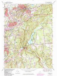
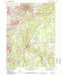
1967 Map of Rockville
USGS Topo · Published 1984About this map
Industrial and residential centers like Rockville and Talcottville anchor the landscape of north-central Connecticut, revealing a region defined by its water resources and evolving transportation network. The Hockanum River and Tankerhoosen River systems historically powered local mills, while the mid-20th-century expansion of the Wilbur Cross Highway and I-84 fundamentally reshaped local travel. Significant recreation and conservation areas are prominent, including the expansive Shenipsit Lake and Bolton Notch State Park.
Find a feature on this map
74 named features on this map. Tap any name to fly to it.
Don’t see what you’re looking for? This feature index may not catch every label — zoom into the map to look around manually.
Map Details
Editions of this 1967 Rockville Map
5 editions found
Other maps of this area

1892 · Hartford
USGS Topo · 1:62,500

1892 · Tolland
USGS Topo · 1:62,500

1892 · Gilead
USGS Topo · 1:62,500

1893 · Middletown
USGS Topo · 1:62,500

1906 · Farmington
USGS Topo · 1:125,000

1921 · Tolland
USGS Topo · 1:62,500

1928 · Glastonbury
USGS Topo · 1:24,000

1928 · Broad Brook
USGS Topo · 1:24,000

1928 · Manchester
USGS Topo · 1:24,000

1944 · Manchester
USGS Topo · 1:31,680