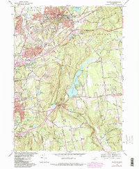
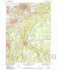
1967 Map of Rockville
USGS Topo · Published 1987About this map
Rockville serves as the industrial and population hub of this portion of Tolland County, centered around Paper Mill Pond and the Hockanum River. The landscape reveals a transition from these dense textile-era settlements to the expanding suburban and recreation-focused areas of the mid-20th century. Suburban growth is evident in the purple-tinted extensions near Vernon Center and Manchester, where new residential streets and schools like Northeast School and Skinner Road School appear alongside established turnpikes.
Find a feature on this map
81 named features on this map. Tap any name to fly to it.
Don’t see what you’re looking for? This feature index may not catch every label — zoom into the map to look around manually.
Map Details
Editions of this 1967 Rockville Map
5 editions found
Other maps of this area

1892 · Hartford
USGS Topo · 1:62,500

1892 · Tolland
USGS Topo · 1:62,500

1892 · Gilead
USGS Topo · 1:62,500

1893 · Middletown
USGS Topo · 1:62,500

1906 · Farmington
USGS Topo · 1:125,000

1921 · Tolland
USGS Topo · 1:62,500

1928 · Glastonbury
USGS Topo · 1:24,000

1928 · Broad Brook
USGS Topo · 1:24,000

1928 · Manchester
USGS Topo · 1:24,000

1944 · Manchester
USGS Topo · 1:31,680