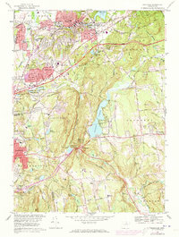
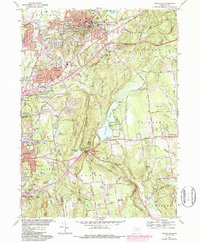
1967 Map of Rockville
USGS Topo · Published 1973About this map
Rockville sits as the dense industrial and civic heart of this Tolland County landscape, where the Hockanum River and Paper Mill Pond historically powered the local manufacturing base. By the mid-1960s, the rise of the Wilbur Cross Highway had begun to reshape the surrounding towns of Vernon Center and Bolton, bridging the gap between old mill villages and emerging suburban clusters. The map reveals a transition from the compact grid of the city to the more open, wooded terrain of Bolton Notch State Park and the high points of Box Mountain.
Find a feature on this map
68 named features on this map. Tap any name to fly to it.
Don’t see what you’re looking for? This feature index may not catch every label — zoom into the map to look around manually.
Map Details
Editions of this 1967 Rockville Map
5 editions found
Other maps of this area

1892 · Hartford
USGS Topo · 1:62,500

1892 · Tolland
USGS Topo · 1:62,500

1892 · Gilead
USGS Topo · 1:62,500

1893 · Middletown
USGS Topo · 1:62,500

1906 · Farmington
USGS Topo · 1:125,000

1921 · Tolland
USGS Topo · 1:62,500

1928 · Glastonbury
USGS Topo · 1:24,000

1928 · Broad Brook
USGS Topo · 1:24,000

1928 · Manchester
USGS Topo · 1:24,000

1944 · Manchester
USGS Topo · 1:31,680