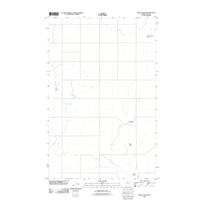
2011 Map of Rocky Coulee
USGS Topo · Published 2011About this map
Rocky Coulee carves through the northern Montana plains in Hill County, where the landscape is defined by its intermittent water sources and ranching infrastructure. This survey illustrates a quiet, rural interior dominated by ephemeral drainage systems like the East Fork Black Coulee. The presence of numerous small reservoirs and named water features suggests the importance of water management in this dry agricultural environment. Named landmarks such as A C Lincoln Dam, Cool Black Rock Dam, and Black Cheese Dam serve as key navigational points and indicators of local land use. Beyond these small-scale improvements, the terrain remains largely open and sparsely developed, with Cockerel Spring providing one of the few natural permanent water points in the quadrangle, while County Rd 55 S provides the primary north-south passage through the eastern half of the sheet.
Find a feature on this map
7 named features on this map. Tap any name to fly to it.
Don’t see what you’re looking for? This feature index may not catch every label — zoom into the map to look around manually.
Map Details
Editions of this 2011 Rocky Coulee Map
This is the sole edition of this map. No revisions or reprints were ever made.
Other maps of this area

1919 · Alma
USGS Topo · 1:125,000

1954 · Shelby
USGS Topo · 1:250,000

1958 · Shelby
USGS Topo · 1:250,000

1963 · Joplin
USGS Topo · 1:24,000

1970 · Poverty Coulee NE
USGS Topo · 1:24,000
1970 · Rocky Coulee SE
USGS Topo · 1:24,000

1970 · Poverty Coulee SE
USGS Topo · 1:24,000

1970 · Rocky Coulee SW
USGS Topo · 1:24,000

1970 · Rocky Coulee
USGS Topo · 1:24,000
1970 · Een School
USGS Topo · 1:24,000