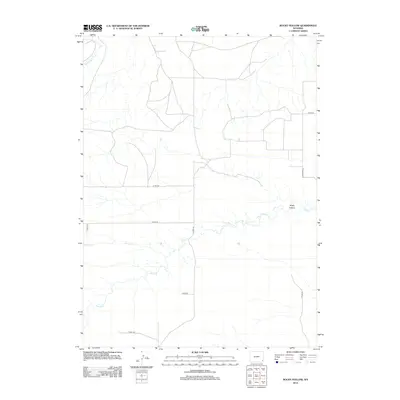
2012 Map of Rocky Hollow
USGS Topo · Published 2012About this map
Horse Cr and its tributaries define the drainage patterns of this Laramie County landscape, where the terrain is marked by the eponymous Rocky Hollow. This 2012 survey illustrates a sparse, rural environment dominated by a grid of county roads and essential water sources, including Cattail Cr and Dater Cr. The infrastructure consists primarily of localized transit routes such as Co Rd-238 and Road 143, which weave through the prairie land. These labels indicate a region focused on ranching or land management rather than dense settlement, with Spring Run and 4 Corners Rd serving as key orientation points for anyone navigating this section of Wyoming. The map records the exact configuration of these ephemeral streams and access roads before further modern development or changes in land use.
Find a feature on this map
14 named features on this map. Tap any name to fly to it.
Don’t see what you’re looking for? This feature index may not catch every label — zoom into the map to look around manually.
Map Details
Editions of this 2012 Rocky Hollow Map
This is the sole edition of this map. No revisions or reprints were ever made.
Other maps of this area

1899 · Goshen Hole
USGS Topo · 1:125,000

1911 · Cheyenne
USGS Topo · 1:125,000

1914 · Cheyenne
USGS Topo · 1:125,000

1954 · Cheyenne
USGS Topo · 1:250,000

1958 · Cheyenne
USGS Topo · 1:250,000

1960 · Diamond Flat
USGS Topo · 1:24,000

1960 · Rocky Hollow
USGS Topo · 1:24,000

1960 · Kessler Gap
USGS Topo · 1:24,000

1960 · Meriden
USGS Topo · 1:24,000

1963 · Little Indian Draw
USGS Topo · 1:24,000