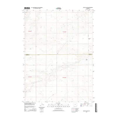
2015 Map of Rocky Hollow
USGS Topo · Published 2015About this map
The Goshen Co Laramie Co boundary bisects this high plains landscape, where the drainage patterns of the Great Plains define the settlement geography. The terrain is characterized by broad coulees and seasonal watercourses, including the southern reaches of Bear Creek and the meandering Cattail Cr. A notable man-made feature is Missile Rd in the southwestern corner, reflecting the region's mid-century military infrastructure. The map illustrates a network of rural routes such as 4 Corners Rd and CR-143, which connect the disparate sections of this ranching country. The land is largely organized around natural depressions and draws, most notably the eponymous Rocky Hollow and the extensive Fourmile Draw in the northeast, which serve as primary markers in an otherwise uniform topography.
Find a feature on this map
20 named features on this map. Tap any name to fly to it.
Don’t see what you’re looking for? This feature index may not catch every label — zoom into the map to look around manually.
Map Details
Editions of this 2015 Rocky Hollow Map
This is the sole edition of this map. No revisions or reprints were ever made.
Other maps of this area

1899 · Goshen Hole
USGS Topo · 1:125,000

1911 · Cheyenne
USGS Topo · 1:125,000

1914 · Cheyenne
USGS Topo · 1:125,000

1954 · Cheyenne
USGS Topo · 1:250,000

1958 · Cheyenne
USGS Topo · 1:250,000

1960 · Diamond Flat
USGS Topo · 1:24,000

1960 · Rocky Hollow
USGS Topo · 1:24,000

1960 · Kessler Gap
USGS Topo · 1:24,000

1960 · Meriden
USGS Topo · 1:24,000

1963 · Little Indian Draw
USGS Topo · 1:24,000