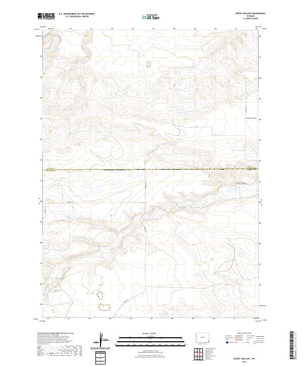
2021 Map of Rocky Hollow
USGS Topo · Published 2021About this map
Rocky Hollow defines the southeastern terrain of this high plains region, where the Goshen Co Laramie Co line divides the landscape. The drainage network is anchored by Horse Cr, which flows eastward through the center of the sheet, joined by tributaries like Cattail Cr and Dater Cr. The area is characterized by a sparse grid of rural transport routes, including the curiously named Missile Rd in the southwest and 4 Corners Rd in the east. This section of the Wyoming borderlands shows a clear township and range survey structure, punctuated by landforms such as Fourmile Draw and Spring Run. The limited infrastructure beyond names like Bear Creek Rd and Schliske Rd reflects the open ranching and agricultural character of this corner of the state.
Find a feature on this map
21 named features on this map. Tap any name to fly to it.
Don’t see what you’re looking for? This feature index may not catch every label — zoom into the map to look around manually.
Map Details
Editions of this 2021 Rocky Hollow Map
This is the sole edition of this map. No revisions or reprints were ever made.
Other maps of this area

1899 · Goshen Hole
USGS Topo · 1:125,000

1911 · Cheyenne
USGS Topo · 1:125,000

1914 · Cheyenne
USGS Topo · 1:125,000

1954 · Cheyenne
USGS Topo · 1:250,000

1958 · Cheyenne
USGS Topo · 1:250,000

1960 · Diamond Flat
USGS Topo · 1:24,000

1960 · Rocky Hollow
USGS Topo · 1:24,000

1960 · Kessler Gap
USGS Topo · 1:24,000

1960 · Meriden
USGS Topo · 1:24,000

1963 · Little Indian Draw
USGS Topo · 1:24,000