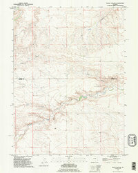
1990 Map of Rocky Hollow
USGS Topo · Published 1995About this map
The high plains of Southeast Wyoming are defined by the winding drainages of Dater Creek and Horse Creek in this 1990 survey. Spanning the boundary of Goshen Co and Laramie Co, the landscape is marked by the eponymous Rocky Hollow and the smaller Cattail Creek to the southwest. The mapping reveals a sparse but deliberate pattern of range management, where ranch tracks and fence lines follow the contours of the breaks and draws. This topographic study captures a moment of modern ranching life, showing the exact placement of windmills and remote ranching infrastructure that supports the livestock industry in this arid environment.
Find a feature on this map
6 named features on this map. Tap any name to fly to it.
Don’t see what you’re looking for? This feature index may not catch every label — zoom into the map to look around manually.
Map Details
Editions of this 1990 Rocky Hollow Map
This is the sole edition of this map. No revisions or reprints were ever made.
Other maps of this area

1899 · Goshen Hole
USGS Topo · 1:125,000

1911 · Cheyenne
USGS Topo · 1:125,000

1914 · Cheyenne
USGS Topo · 1:125,000

1954 · Cheyenne
USGS Topo · 1:250,000

1958 · Cheyenne
USGS Topo · 1:250,000

1960 · Diamond Flat
USGS Topo · 1:24,000

1960 · Rocky Hollow
USGS Topo · 1:24,000

1960 · Kessler Gap
USGS Topo · 1:24,000

1960 · Meriden
USGS Topo · 1:24,000

1963 · Little Indian Draw
USGS Topo · 1:24,000