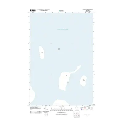
2011 Map of Rocky Island
USGS Topo · Published 2011About this map
Rocky Island and several neighboring landforms in the Apostle Islands archipelago define this 2011 survey, situated within the cold waters of Lake Superior. The map centers on the isolated outpost of Hadland Fishing Camp on the southeastern shore of Rocky Island, providing a clear look at the human footprint in this maritime environment. To the north, the solitary landmass of Devils Island is flanked by the underwater hazards of Devils Island Shoal, while South Twin Island sits to the east, illustrating the clustered geography of these northernmost Wisconsin islands. This edition is particularly useful for maritime historians and those interested in the legacy of commercial fishing and island habitation in Ashland County.
Find a feature on this map
6 named features on this map. Tap any name to fly to it.
Don’t see what you’re looking for? This feature index may not catch every label — zoom into the map to look around manually.
Map Details
Editions of this 2011 Rocky Island Map
This is the sole edition of this map. No revisions or reprints were ever made.
Other maps of this area

1941 · Bayfield
USGS Topo · 1:48,000

1946 · Bayfield
USGS Topo · 1:48,000

1953 · Ashland
USGS Topo · 1:250,000

1954 · Two Harbors
USGS Topo · 1:250,000

1957 · Two Harbors
USGS Topo · 1:250,000

1958 · Ashland
USGS Topo · 1:250,000

1958 · Two Harbors
USGS Topo · 1:250,000

1963 · Cat Island
USGS Topo · 1:24,000

1963 · Rocky Island
USGS Topo · 1:62,500

1963 · Oak Island
USGS Topo · 1:24,000