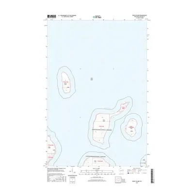
2015 Map of Rocky Island
USGS Topo · Published 2015About this map
Apostle Islands National Lakeshore encompasses several distinct landmasses within the cold waters of Lake Superior, providing a specialized look at the northernmost reaches of Wisconsin. The isolation of Devils Island at the northern edge of the archipelago is contrasted by the proximity of Rocky Island and South Twin Island to the southeast. These islands are part of a protected maritime landscape that preserves the natural state of the archipelago, where underwater features like Devils Island Shoal pose challenges to navigation. Further south, the map details the shorelines of Bear Island, Otter Island, and Ironwood Island, illustrating the distribution of these landforms across the coastal waters of Ashland County. The survey provides a clear view of the federal boundaries and the varied topography of each island within the national lakeshore.
Find a feature on this map
13 named features on this map. Tap any name to fly to it.
Don’t see what you’re looking for? This feature index may not catch every label — zoom into the map to look around manually.
Map Details
Editions of this 2015 Rocky Island Map
This is the sole edition of this map. No revisions or reprints were ever made.
Other maps of this area

1941 · Bayfield
USGS Topo · 1:48,000

1946 · Bayfield
USGS Topo · 1:48,000

1953 · Ashland
USGS Topo · 1:250,000

1954 · Two Harbors
USGS Topo · 1:250,000

1957 · Two Harbors
USGS Topo · 1:250,000

1958 · Ashland
USGS Topo · 1:250,000

1958 · Two Harbors
USGS Topo · 1:250,000

1963 · Cat Island
USGS Topo · 1:24,000

1963 · Rocky Island
USGS Topo · 1:62,500

1963 · Oak Island
USGS Topo · 1:24,000