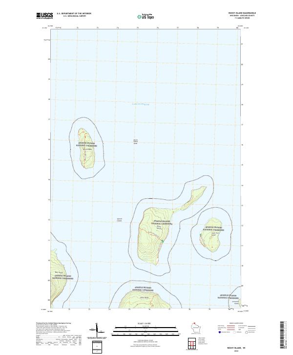
2022 Map of Rocky Island
USGS Topo · Published 2022About this map
Apostle Islands National Lakeshore protects a distinct archipelago in Lake Superior, where isolation and geology define the landscape. This 2022 survey documents the varied islands of the northern chain, from the northernmost reaches of Devils Island and its nearby Devils Island Shoal to the larger landmasses of Rocky Island and South Twin Island. The map records essential trail infrastructure used for navigating these remote island interiors, specifically the Rocky Island Steps Trl and the South Twin Island Trl. Surrounding islands such as Bear Island, Otter Island, and Ironwood Island are also shown, illustrating the spatial relationship between these glaciated landforms. The presence of these named islands and their internal paths provides a clear record of the modern shoreline and recreational access within this protected maritime region of Ashland County.
Find a feature on this map
18 named features on this map. Tap any name to fly to it.
Don’t see what you’re looking for? This feature index may not catch every label — zoom into the map to look around manually.
Map Details
Editions of this 2022 Rocky Island Map
This is the sole edition of this map. No revisions or reprints were ever made.
Other maps of this area

1941 · Bayfield
USGS Topo · 1:48,000

1946 · Bayfield
USGS Topo · 1:48,000

1953 · Ashland
USGS Topo · 1:250,000

1954 · Two Harbors
USGS Topo · 1:250,000

1957 · Two Harbors
USGS Topo · 1:250,000

1958 · Ashland
USGS Topo · 1:250,000

1958 · Two Harbors
USGS Topo · 1:250,000

1963 · Cat Island
USGS Topo · 1:24,000

1963 · Rocky Island
USGS Topo · 1:62,500

1963 · Oak Island
USGS Topo · 1:24,000