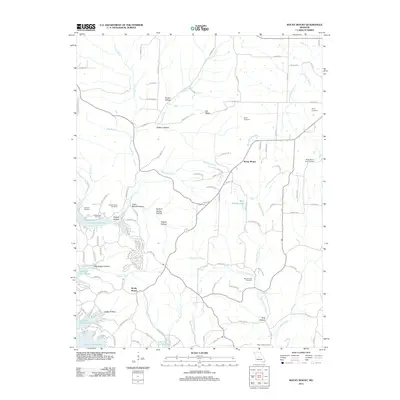
2011 Map of Rocky Mount
USGS Topo · Published 2011About this map
Rocky Mount serves as the focal point of this 2011 Missouri survey, situated within the complex hydrography of the Lake of the Ozarks region. The landscape is defined by its dendritic drainage patterns, with Indian Creek, Blue Spring Creek, and South Moreau Creek carving out several named hollows like Routon Hollow and Shelton Hollow. For genealogical researchers, the map provides precise locations for family-named sites such as Taylor Cemetery, Blue Springs Cemetery, and the Riley Lamb Cemetery. The topography transitions from the high ground of Dill Ridge down to the fingers of the reservoir, illustrating the mid-20th century inundation that shaped this area. Notable landmarks include the Rocky Mount Lookout Tower and smaller bodies of water like Blue Springs Lake, offering a detailed view of the contemporary rural infrastructure and land use in Morgan and Miller counties.
Find a feature on this map
122 named features on this map. Tap any name to fly to it.
Don’t see what you’re looking for? This feature index may not catch every label — zoom into the map to look around manually.
Map Details
Editions of this 2011 Rocky Mount Map
This is the sole edition of this map. No revisions or reprints were ever made.
Other maps of this area

1888 · Versailles
USGS Topo · 1:125,000

1893 · Versailles
USGS Topo · 1:125,000

1904 · Eldon
USGS Topo · 1:62,500

1904 · Gravois Mills
USGS Topo · 1:62,500

1932 · Versailles No 4
USGS Topo · 1:48,000

1934 · Purvis
USGS Topo · 1:24,000

1934 · Lake Ozark
USGS Topo · 1:24,000

1934 · Bagnell
USGS Topo · 1:24,000

1935 · Gravois Mills
USGS Topo · 1:24,000

1935 · Rocky Mount
USGS Topo · 1:24,000