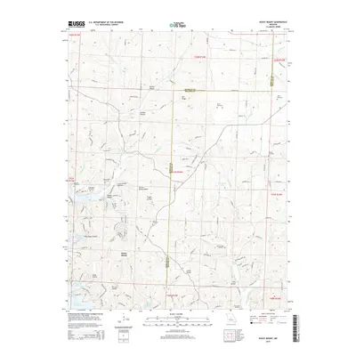
2015 Map of Rocky Mount
USGS Topo · Published 2015About this map
Rocky Mount serves as the central settlement in this area of the northern Ozarks, situated along the border of Morgan and Miller counties. The landscape is defined by a dense network of hollows, including Routon, Shelton, and Raccoon Hollow, which channel drainage toward the complex shoreline of the Lake of the Ozarks. This survey reveals a high concentration of small family and community burial grounds, such as the White Cemetery, Taylor Cemetery, and Riley Lamb Cemetery, which are vital for genealogical research in this part of Missouri. The map illustrates how local transportation relies on a web of county roads, such as Co Road Y-40 and Co Road Z-8, which follow the winding ridgelines and creek beds like Blue Spring Creek and McKinley Creek.
Find a feature on this map
126 named features on this map. Tap any name to fly to it.
Don’t see what you’re looking for? This feature index may not catch every label — zoom into the map to look around manually.
Map Details
Editions of this 2015 Rocky Mount Map
This is the sole edition of this map. No revisions or reprints were ever made.
Other maps of this area

1888 · Versailles
USGS Topo · 1:125,000

1893 · Versailles
USGS Topo · 1:125,000

1904 · Eldon
USGS Topo · 1:62,500

1904 · Gravois Mills
USGS Topo · 1:62,500

1932 · Versailles No 4
USGS Topo · 1:48,000

1934 · Purvis
USGS Topo · 1:24,000

1934 · Lake Ozark
USGS Topo · 1:24,000

1934 · Bagnell
USGS Topo · 1:24,000

1935 · Gravois Mills
USGS Topo · 1:24,000

1935 · Rocky Mount
USGS Topo · 1:24,000