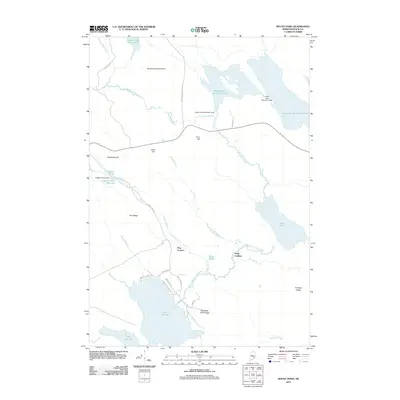
2011 Map of Rocky Pond
USGS Topo · Published 2011About this map
Dog Corners serves as a small crossroads hub in this forested Maine landscape, where the East Branch Union River and several major water bodies define the local geography. The map reveals a highly managed hydrological system, marked by the Upper Lead Mountain Dam, Lower Lead Mountain Dam, and the Leighton River Dam which forms the Leighton River Reservoir. These water control points suggest the region's historic reliance on river systems for power or transport, particularly along the Leighton Brook and Starvation Branch.
Find a feature on this map
40 named features on this map. Tap any name to fly to it.
Don’t see what you’re looking for? This feature index may not catch every label — zoom into the map to look around manually.
Map Details
Editions of this 2011 Rocky Pond Map
This is the sole edition of this map. No revisions or reprints were ever made.
Other maps of this area

1911 · Ellsworth
USGS Topo · 1:62,500

1929 · Great Pond
USGS Topo · 1:48,000

1929 · Lead Mountain
USGS Topo · 1:48,000

1930 · Tunk Lake
USGS Topo · 1:48,000

1932 · Tunk Lake
USGS Topo · 1:62,500

1932 · Lead Mountain
USGS Topo · 1:62,500

1932 · Great Pond
USGS Topo · 1:62,500

1940 · Ellsworth
USGS Topo · 1:62,500

1942 · Ellsworth
USGS Topo · 1:62,500

1942 · Tunk Lake
USGS Topo · 1:62,500