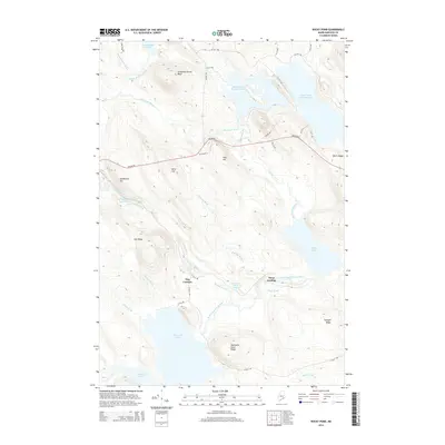
2014 Map of Rocky Pond
USGS Topo · Published 2014About this map
Middle Br Union River and the East Branch Union River define the watery corridor of this Hancock County landscape. The road network is dominated by the historic Airline Rd and its predecessor, Old Route 9, which traverse a terrain of high ridges and isolated peaks. This interior Maine territory is marked by significant water bodies, including the expansive Spectacle Pond in the south and the Middle Lead Mountain Pond chain to the north. Small settlements and specialized locations such as Dog Corners and Steep Landing appear amidst the timberlands, connected by a web of named forestry roads. Elevation changes are pronounced at landmarks like Sevenmile Brook Bluff and Schoppe Ridge, illustrating the drainage patterns of the Mahanon Brook and Roaring Brook systems that feed the region's prominent ponds.
Find a feature on this map
47 named features on this map. Tap any name to fly to it.
Don’t see what you’re looking for? This feature index may not catch every label — zoom into the map to look around manually.
Map Details
Editions of this 2014 Rocky Pond Map
This is the sole edition of this map. No revisions or reprints were ever made.
Other maps of this area

1911 · Ellsworth
USGS Topo · 1:62,500

1929 · Great Pond
USGS Topo · 1:48,000

1929 · Lead Mountain
USGS Topo · 1:48,000

1930 · Tunk Lake
USGS Topo · 1:48,000

1932 · Tunk Lake
USGS Topo · 1:62,500

1932 · Lead Mountain
USGS Topo · 1:62,500

1932 · Great Pond
USGS Topo · 1:62,500

1940 · Ellsworth
USGS Topo · 1:62,500

1942 · Ellsworth
USGS Topo · 1:62,500

1942 · Tunk Lake
USGS Topo · 1:62,500