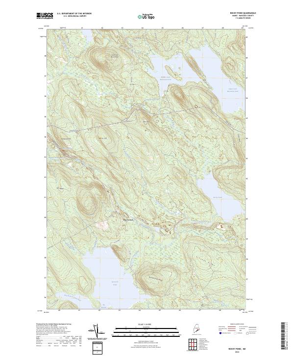
2024 Map of Rocky Pond
USGS Topo · Published 2024About this map
Dog Corners marks a focal point in this landscape where the Spectacle Pond Rd intersects with historic routes like the Airline Rd and Old Rte 9. The terrain is defined by a dense network of hydrologic features and named ridges, illustrating a classic Maine timber and water-power topography. Significant water bodies such as Middle Lead Mountain Pond, Upper Lead Mountain Pond, and Rocky Pond dominate the northern and eastern sections, while the western portion is shaped by the Leighton River Reservoir.
Find a feature on this map
49 named features on this map. Tap any name to fly to it.
Don’t see what you’re looking for? This feature index may not catch every label — zoom into the map to look around manually.
Map Details
Editions of this 2024 Rocky Pond Map
This is the sole edition of this map. No revisions or reprints were ever made.
Other maps of this area

1911 · Ellsworth
USGS Topo · 1:62,500

1929 · Great Pond
USGS Topo · 1:48,000

1929 · Lead Mountain
USGS Topo · 1:48,000

1930 · Tunk Lake
USGS Topo · 1:48,000

1932 · Tunk Lake
USGS Topo · 1:62,500

1932 · Lead Mountain
USGS Topo · 1:62,500

1932 · Great Pond
USGS Topo · 1:62,500

1940 · Ellsworth
USGS Topo · 1:62,500

1942 · Ellsworth
USGS Topo · 1:62,500

1942 · Tunk Lake
USGS Topo · 1:62,500