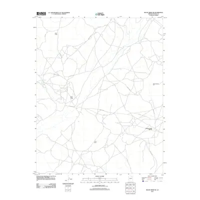
2011 Map of Rocky Ridge SE
USGS Topo · Published 2011About this map
Third Mesa dominates the southern landscape of this 2011 survey, a region defined by high desert terrain and sparse, resilient settlements. The community of Rocky Ridge serves as a central hub, connected to the surrounding plateau by a network of designated routes including Cliff Rdg and Indian Rte 6620. In the northeast, Many Bobcats Hill rises above the mesa, while isolated outposts like Toh Honi Ni Toh and Toh Ah Honnie Betoh mark long-established points of habitation near ephemeral water sources like To Cai. The presence of the Navajo Gospel Mission and the Rocky Ridge Airport illustrates the modern infrastructure supporting this Navajo Nation landscape. This map preserves the contemporary road network and traditional place names that anchor the cultural geography of this portion of Arizona.
Find a feature on this map
19 named features on this map. Tap any name to fly to it.
Don’t see what you’re looking for? This feature index may not catch every label — zoom into the map to look around manually.
Map Details
Editions of this 2011 Rocky Ridge SE Map
This is the sole edition of this map. No revisions or reprints were ever made.
Other maps of this area

1883 · Marsh Pass
USGS Topo · 1:250,000

1883 · Tusayan
USGS Topo · 1:250,000

1886 · Tusayan
USGS Topo · 1:250,000

1892 · Marsh Pass
USGS Topo · 1:250,000

1947 · Flagstaff
USGS Topo · 1:250,000

1954 · Flagstaff
USGS Topo · 1:250,000

1956 · Marble Canyon
USGS Topo · 1:250,000

1958 · Flagstaff
USGS Topo · 1:250,000

1959 · Marble Canyon
USGS Topo · 1:250,000

1960 · Flagstaff
USGS Topo · 1:250,000