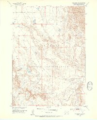
1951 Map of Rockyford NW
USGS Topo · Published 1953About this map
Pine Ridge Indian Reservation lands dominate this mid-century landscape in South Dakota, showing a topography defined by wide plateaus and intricate drainage systems. The White River flows through the southeastern corner of the quadrangle, carving a distinct path through the terrain. To the west, the prominent elevation of Red Dog Table rises above the surrounding valleys, serving as a significant landmark in this part of Oglala Lakota County. The map details a network of seasonal and perennial waterways including Sand Creek and the bifurcated paths of East Horse Creek and West Horse Creek. This 1951 field-checked survey illustrates a region where land use was largely shaped by the natural contours of the High Plains and the administrative boundaries of the reservation. The absence of dense town sites highlights the rural character of the area, where geographical features like the "tables" provided critical orientation for residents and travelers alike.
Find a feature on this map
10 named features on this map. Tap any name to fly to it.
Don’t see what you’re looking for? This feature index may not catch every label — zoom into the map to look around manually.
Map Details
Editions of this 1951 Rockyford NW Map
2 editions found
Other maps of this area

1950 · Stirk Table
USGS Topo · 1:24,000

1950 · Cuny Table East
USGS Topo · 1:24,000

1951 · Rockyford SW
USGS Topo · 1:24,000

1951 · Rockyford NW
USGS Topo · 1:24,000

1951 · Willow Creek NE
USGS Topo · 1:24,000

1951 · Rockyford
USGS Topo · 1:24,000

1951 · Rockyford SE
USGS Topo · 1:24,000

1951 · Cuny Table West
USGS Topo · 1:24,000

1955 · Hot Springs
USGS Topo · 1:250,000

1967 · Willow Creek
USGS Topo · 1:24,000