
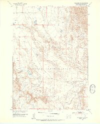
1951 Map of Rockyford NW
USGS Topo · Published 1953About this map
The Pine Ridge Indian Reservation landscape is defined by the sharp transition between tablelands and river valleys in this 1951 study. High ground is dominated by Red Dog Table, which overlooks a complex network of drainages moving toward the southern and eastern edges of the quadrangle. The White River carves a significant path through the southeastern corner, supported by seasonal tributaries including East Horse Creek and Sand Creek. The map documents a sparse, open topography typical of the High Plains before modern infrastructure expansion, focusing on the natural drainage patterns and the distinct geological benches that characterize this part of Shannon County. This data was compiled as part of the Department of the Interior's Missouri River Basin development program, following aerial photography conducted in 1949.
Find a feature on this map
7 named features on this map. Tap any name to fly to it.
Don’t see what you’re looking for? This feature index may not catch every label — zoom into the map to look around manually.
Map Details
Editions of this 1951 Rockyford NW Map
2 editions found
Other maps of this area

1950 · Stirk Table
USGS Topo · 1:24,000

1950 · Cuny Table East
USGS Topo · 1:24,000

1951 · Rockyford SW
USGS Topo · 1:24,000

1951 · Willow Creek NE
USGS Topo · 1:24,000

1951 · Rockyford
USGS Topo · 1:24,000

1951 · Rockyford SE
USGS Topo · 1:24,000

1951 · Cuny Table West
USGS Topo · 1:24,000

1955 · Hot Springs
USGS Topo · 1:250,000

1967 · Willow Creek
USGS Topo · 1:24,000

1981 · Wall
USGS Topo · 1:100,000