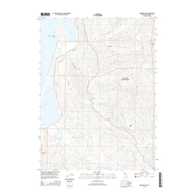
2015 Map of Rodgers Peak
USGS Topo · Published 2015About this map
Redwood National Park occupies the central and eastern portions of this coastal landscape, where high ridgelines descend toward the Pacific Ocean. The coastline is defined by a series of significant water bodies, including Stone Lagoon, Dry Lagoon, and the northern reaches of Big Lagoon, separated from the sea by narrow strips of land. These lagoons are fed by numerous drainages such as Maple Creek, Diamond Cr, and Tom Cr.
Find a feature on this map
66 named features on this map. Tap any name to fly to it.
Don’t see what you’re looking for? This feature index may not catch every label — zoom into the map to look around manually.
Map Details
Editions of this 2015 Rodgers Peak Map
This is the sole edition of this map. No revisions or reprints were ever made.
Other maps of this area

1925 · Hoopa
USGS Topo · 1:125,000

1945 · Orick
USGS Topo · 1:62,500

1945 · Trinidad
USGS Topo · 1:62,500

1945 · Coyote Peak
USGS Topo · 1:62,500

1945 · Tectah Creek
USGS Topo · 1:62,500

1948 · Weed
USGS Topo · 1:250,000

1949 · Eureka
USGS Topo · 1:250,000

1950 · Weed
USGS Topo · 1:250,000
1952 · Orick
USGS Topo · 1:62,500

1952 · Coyote Peak
USGS Topo · 1:62,500