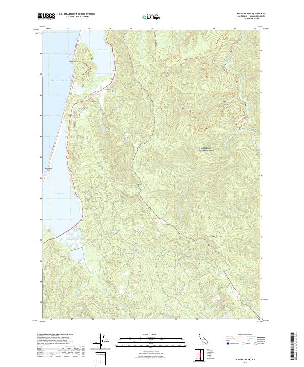
2021 Map of Rodgers Peak
USGS Topo · Published 2021About this map
The coastal interface of Humboldt County is defined here by the massive lagoon systems of Big Lagoon and Stone Lagoon, separated from the Pacific Ocean by the narrow Big Lagoon Spit. This 2021 survey illustrates the complex hydrology of the region, where the Big Lagoon Marsh meets drainage from Maple Creek and Tom Cr. Inland, the terrain rises sharply toward Rodgers Peak, dominated by the protected old-growth and secondary forests of Redwood National Park. The map documents a specialized network of access points and trails, including the Tall Trees Trl and Elam Creek Loop Trl, which provide access to the interior watersheds of Redwood Creek and Fortyfour Cr. Local infrastructure such as Big Lagoon Ranch Rd and Hammond Truck Rd show how historical ranching and timber access routes have been integrated into the modern park and residential landscape.
Find a feature on this map
43 named features on this map. Tap any name to fly to it.
Don’t see what you’re looking for? This feature index may not catch every label — zoom into the map to look around manually.
Map Details
Editions of this 2021 Rodgers Peak Map
This is the sole edition of this map. No revisions or reprints were ever made.
Other maps of this area

1925 · Hoopa
USGS Topo · 1:125,000

1945 · Orick
USGS Topo · 1:62,500

1945 · Trinidad
USGS Topo · 1:62,500

1945 · Coyote Peak
USGS Topo · 1:62,500

1945 · Tectah Creek
USGS Topo · 1:62,500

1948 · Weed
USGS Topo · 1:250,000

1949 · Eureka
USGS Topo · 1:250,000

1950 · Weed
USGS Topo · 1:250,000
1952 · Orick
USGS Topo · 1:62,500

1952 · Coyote Peak
USGS Topo · 1:62,500