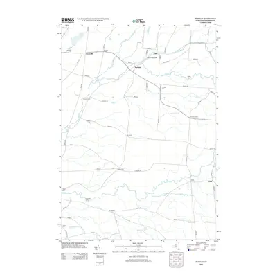
2013 Map of Rodman
USGS Topo · Published 2013About this map
Rodman and Lorraine anchor this landscape of Jefferson County, where the network of the Sandy Cr and its many branches like N Br Sandy Cr and S Sandy Cr carve deep features into the terrain. The presence of Inman Gulf, Towle Gulf, and Lorraine Gulf indicates a geography of sharp relief, where water has defined the passage of roads and the placement of early settlements. Genealogists will find a wealth of specific landmarks including Isham Cem, Zoar Cem, and Honeyville Cem, alongside historical crossroads like Whitford Corners and Tremaines Corners. The settlement of Worth and the small community of Zoar remain connected by rural corridors such as Co Rte-189 and Co Rte-95, reflecting a persistent rural pattern that has endured through the early 21st century.
Find a feature on this map
81 named features on this map. Tap any name to fly to it.
Don’t see what you’re looking for? This feature index may not catch every label — zoom into the map to look around manually.
Map Details
Editions of this 2013 Rodman Map
This is the sole edition of this map. No revisions or reprints were ever made.
Other maps of this area

1893 · Sackets Harbor
USGS Topo · 1:62,500

1895 · Sacketts Harbor
USGS Topo · 1:62,500

1895 · Pulaski
USGS Topo · 1:62,500

1895 · Watertown
USGS Topo · 1:62,500

1898 · Watertown
USGS Topo · 1:62,500

1903 · Orwell
USGS Topo · 1:62,500

1905 · Orwell
USGS Topo · 1:62,500

1908 · Watertown
USGS Topo · 1:62,500

1909 · Watertown
USGS Topo · 1:62,500

1942 · Sandy Creek
USGS Topo · 1:24,000