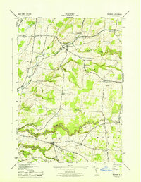
1943 Map of Rodman
USGS Topo · Published 1943About this map
The Old Rome State Road anchors the western edge of this 1943 Jefferson County landscape, serving as a historic corridor through a region defined by its numerous rural schoolhouses and family cemeteries. At the heart of the terrain, Rodman and Lorraine sit as primary hubs connected by a network of winding local routes like the Waterville Lorraine Worth Center Road. This wartime-era survey, completed by the Tennessee Valley Authority for the War Department, provides an unusually dense record of early twentieth-century rural infrastructure, specifically noted in the distribution of one-room schools such as School No 3 and School No 11. The topography is deeply incised by complex drainage patterns, including Inman Gulf and Totman Gulf, where Sandy Creek and its branches have carved significant ravines into the plateau.
Find a feature on this map
51 named features on this map. Tap any name to fly to it.
Don’t see what you’re looking for? This feature index may not catch every label — zoom into the map to look around manually.
Map Details
Editions of this 1943 Rodman Map
This is the sole edition of this map. No revisions or reprints were ever made.
Other maps of this area

1893 · Sackets Harbor
USGS Topo · 1:62,500

1895 · Sacketts Harbor
USGS Topo · 1:62,500

1895 · Pulaski
USGS Topo · 1:62,500

1895 · Watertown
USGS Topo · 1:62,500

1898 · Watertown
USGS Topo · 1:62,500

1903 · Orwell
USGS Topo · 1:62,500

1905 · Orwell
USGS Topo · 1:62,500

1908 · Watertown
USGS Topo · 1:62,500

1909 · Watertown
USGS Topo · 1:62,500

1942 · Sandy Creek
USGS Topo · 1:24,000