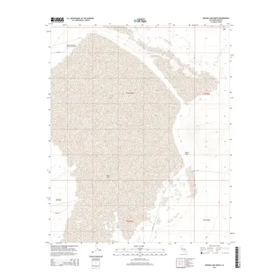
2015 Map of Rogers Lake North
USGS Topo · Published 2015About this map
Rogers Lake dominates this arid landscape, its dry bed appearing as a massive light-colored expanse within the high Mojave Desert. This 2015 survey details the specialized infrastructure of the Edwards Air Force Base, including the Edwards Air Force Auxiliary North Base along the northern perimeter. The map illustrates a strictly functional grid of military and service roads, such as Hospital Rd, N Base Rd, and N Mercury Blvd, which cut across the desert floor to support aerospace operations. The presence of significant Silt deposits at the northeastern edge of the playa suggests the complex hydrological processes of this closed basin. This sheet is particularly useful for understanding the modern footprint of one of the nation's most critical flight test centers and the unique terrain that makes its missions possible.
Find a feature on this map
12 named features on this map. Tap any name to fly to it.
Don’t see what you’re looking for? This feature index may not catch every label — zoom into the map to look around manually.
Map Details
Editions of this 2015 Rogers Lake North Map
This is the sole edition of this map. No revisions or reprints were ever made.
Other maps of this area

1915 · Searles Lake
USGS Topo · 1:250,000

1937 · Kramer
USGS Topo · 1:48,000

1937 · Rogers Lake
USGS Topo · 1:48,000

1942 · Kramer
USGS Topo · 1:62,500

1942 · Rogers Lake
USGS Topo · 1:62,500

1943 · Castle Butte
USGS Topo · 1:62,500

1947 · Fluhr
USGS Topo · 1:24,000

1947 · Castle Butte
USGS Topo · 1:50,000

1947 · Rich
USGS Topo · 1:24,000

1947 · Desert Butte
USGS Topo · 1:24,000