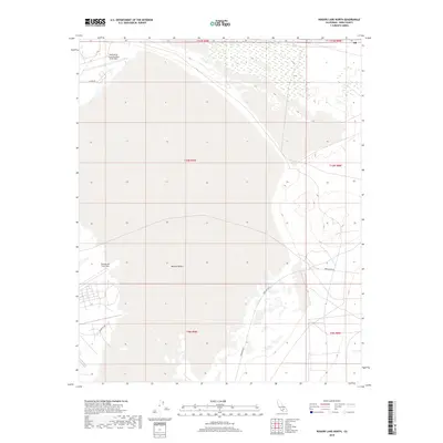
2018 Map of Rogers Lake North
USGS Topo · Published 2018About this map
The Mojave Desert terrain of Kern County dominates this 2018 survey, centered on the strategic installations of Edwards Air Force Base. The landscape is characterized by the expansive dry lake beds and the specialized infrastructure required for aerospace testing. Military facilities, including Edwards Air Force Auxiliary North Base, are connected by a network of service roads such as N Base Rd and Hospital Rd. This edition reflects the modern boundaries of the government reservation, tracing the transition from the open desert floor to the technical installations of the base. The presence of Mercury Blvd indicates the organized layout of the interior base operations, providing a detailed look at the geographic context of one of the country's most significant flight test centers.
Find a feature on this map
12 named features on this map. Tap any name to fly to it.
Don’t see what you’re looking for? This feature index may not catch every label — zoom into the map to look around manually.
Map Details
Editions of this 2018 Rogers Lake North Map
This is the sole edition of this map. No revisions or reprints were ever made.
Other maps of this area

1915 · Searles Lake
USGS Topo · 1:250,000

1937 · Kramer
USGS Topo · 1:48,000

1937 · Rogers Lake
USGS Topo · 1:48,000

1942 · Kramer
USGS Topo · 1:62,500

1942 · Rogers Lake
USGS Topo · 1:62,500

1943 · Castle Butte
USGS Topo · 1:62,500

1947 · Fluhr
USGS Topo · 1:24,000

1947 · Castle Butte
USGS Topo · 1:50,000

1947 · Rich
USGS Topo · 1:24,000

1947 · Desert Butte
USGS Topo · 1:24,000