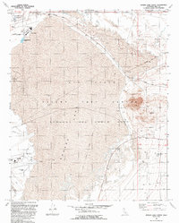
1992 Map of Rogers Lake North
USGS Topo · Published 1992About this map
NASA Jet Propulsion Laboratory and the Air Force Flight Test Center dominate this desert landscape, revealing a high-tech military and scientific infrastructure during the early 1990s. The map detail highlights the specialized facilities of Edwards Air Force Base, including the North Base and South Base complexes. Aviation-specific markings like the Fly-By Line and the Low Altitude Speed Course underscore the area's role in supersonic and experimental flight testing.
Find a feature on this map
29 named features on this map. Tap any name to fly to it.
Don’t see what you’re looking for? This feature index may not catch every label — zoom into the map to look around manually.
Map Details
Editions of this 1992 Rogers Lake North Map
This is the sole edition of this map. No revisions or reprints were ever made.
Other maps of this area

1915 · Searles Lake
USGS Topo · 1:250,000

1937 · Kramer
USGS Topo · 1:48,000

1937 · Rogers Lake
USGS Topo · 1:48,000

1942 · Kramer
USGS Topo · 1:62,500

1942 · Rogers Lake
USGS Topo · 1:62,500

1943 · Castle Butte
USGS Topo · 1:62,500

1947 · Fluhr
USGS Topo · 1:24,000

1947 · Castle Butte
USGS Topo · 1:50,000

1947 · Rich
USGS Topo · 1:24,000

1947 · Desert Butte
USGS Topo · 1:24,000