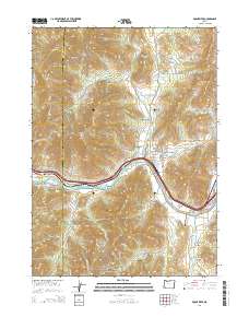
2014 Map of Rogue River
USGS Topo · Published 2014About this map
The Rogue River flows through the heart of this landscape, marking a central corridor for transport and irrigation in southwestern Oregon. The settlement of Rogue River sits near the confluence of Evans Creek, with the Gold Hill Irrigation District Canal and Evans Cr Lateral weaving through the valley to support local agriculture. The terrain rises sharply away from the water to landmarks like Fielder Mtn and Starvation Heights, while the Josephine Co Jackson Co line bisects the western reaches near Old Baldy. For those researching local heritage, the map identifies the Woodville Cem and Foots Cem near the small community of Foots Creek. Numerous gulches and hollows, such as Sugarpine Gulch and Owl Hollow, define the drainage patterns feeding into the main river system alongside smaller impoundments like Smith Reservoir and McCollum Reservoir.
Find a feature on this map
84 named features on this map. Tap any name to fly to it.
Don’t see what you’re looking for? This feature index may not catch every label — zoom into the map to look around manually.
Map Details
Editions of this 2014 Rogue River Map
This is the sole edition of this map. No revisions or reprints were ever made.
Other maps of this area

1904 · Riddle
USGS Topo · 1:125,000

1908 · Grants Pass
USGS Topo · 1:125,000

1954 · Glendale
USGS Topo · 1:62,500

1954 · Gold Hill
USGS Topo · 1:62,500

1954 · Wimer
USGS Topo · 1:62,500

1954 · Grants Pass
USGS Topo · 1:62,500

1955 · Medford
USGS Topo · 1:250,000

1957 · Medford
USGS Topo · 1:250,000

1958 · Medford
USGS Topo · 1:250,000
1974 · Grants Pass NE
USGS Topo · 1:24,000