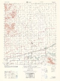
1968 Map of Roll
USGS Topo · Published 1968About this map
The Southern Pacific railroad corridor serves as the primary artery through this arid Yuma County landscape, connecting the small settlement of Roll with the agricultural and ranching operations of the valley. This 1968 study, compiled from earlier aerial photography and field checks, reveals a landscape defined by the intersection of military utility and desert wilderness. The southern portion of the Yuma Proving Ground and other military reservations dominate the central terrain, while the heights of the Castle Dome Mountains and the Kofa Game Range rise to the north. Local life is anchored by features like the Mohawk Valley Sch, Terry Ranch, and several critical water sources including Renner Well and Mesquite Jim Well. The presence of a Canal and multiple Salt Wells indicates the ongoing efforts to manage water for livestock and small-scale settlement in the shadow of the Mohawk Mountains.
Find a feature on this map
19 named features on this map. Tap any name to fly to it.
Don’t see what you’re looking for? This feature index may not catch every label — zoom into the map to look around manually.
Map Details
Editions of this 1968 Roll Map
This is the sole edition of this map. No revisions or reprints were ever made.
Other maps of this area

1926 · Wellton
USGS Topo · 1:62,500

1926 · Mohawk
USGS Topo · 1:62,500

1927 · Kim
USGS Topo · 1:62,500

1928 · Mohawk
USGS Topo · 1:62,500

1928 · Norton
USGS Topo · 1:62,500

1929 · Wellton
USGS Topo · 1:62,500

1929 · Norton
USGS Topo · 1:62,500

1930 · Stoval
USGS Topo · 1:62,500

1931 · Kim
USGS Topo · 1:62,500

1942 · Yuma
USGS Topo · 1:250,000