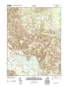
2013 Map of Rollins Fork
USGS Topo · Published 2013About this map
Rappahannock River frontage defines the southern edge of this Westmoreland County landscape, where maritime history meets rural Virginia crossroads. The transition from tidal water to upland farm country is marked by old riverside access points like Greenlaw Wharf and Wilmont Wharf, and navigation landmarks such as Devils Elbow and Horse Head Point. Inland, the settlement pattern is characterized by numerous small forks and corners, including Rollins Fork, Weedons Fork, and Dickinsons Corner, which trace the evolution of local road networks over generations.
Find a feature on this map
88 named features on this map. Tap any name to fly to it.
Don’t see what you’re looking for? This feature index may not catch every label — zoom into the map to look around manually.
Map Details
Editions of this 2013 Rollins Fork Map
This is the sole edition of this map. No revisions or reprints were ever made.
Other maps of this area

1889 · Fredericksburg
USGS Topo · 1:125,000

1892 · Fredericksburg
USGS Topo · 1:125,000

1892 · Montross
USGS Topo · 1:62,500

1894 · Wicomico
USGS Topo · 1:62,500

1894 · Fredericksburg
USGS Topo · 1:125,000

1895 · Wicomico
USGS Topo · 1:62,500

1895 · Nomini
USGS Topo · 1:125,000

1895 · Montross
USGS Topo · 1:62,500

1898 · Nomini
USGS Topo · 1:125,000

1902 · Wicomico
USGS Topo · 1:62,500