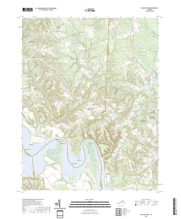
2022 Map of Rollins Fork
USGS Topo · Published 2022About this map
The Rappahannock River dictates the landscape of this coastal plain region, where the borders of King George, Westmoreland, Essex, and Caroline counties meet. The river's winding path creates dramatic geographic features such as Devils Elbow, Horse Head Point, and the wide waters of Portobago Bay and Green Bay. Inland, the terrain is defined by low ridges like Round Hill and numerous creek systems, including Kings Mill Cr and Jetts Cr, which historically influenced settlement patterns and local agricultural boundaries.
Find a feature on this map
100 named features on this map. Tap any name to fly to it.
Don’t see what you’re looking for? This feature index may not catch every label — zoom into the map to look around manually.
Map Details
Editions of this 2022 Rollins Fork Map
This is the sole edition of this map. No revisions or reprints were ever made.
Other maps of this area

1889 · Fredericksburg
USGS Topo · 1:125,000

1892 · Fredericksburg
USGS Topo · 1:125,000

1892 · Montross
USGS Topo · 1:62,500

1894 · Wicomico
USGS Topo · 1:62,500

1894 · Fredericksburg
USGS Topo · 1:125,000

1895 · Wicomico
USGS Topo · 1:62,500

1895 · Nomini
USGS Topo · 1:125,000

1895 · Montross
USGS Topo · 1:62,500

1898 · Nomini
USGS Topo · 1:125,000

1902 · Wicomico
USGS Topo · 1:62,500