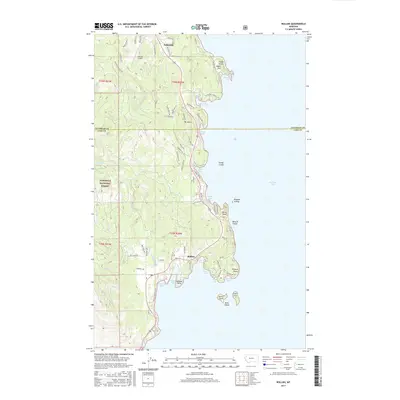
2017 Map of Rollins
USGS Topo · Published 2017About this map
Flathead Lake dominates the eastern margin of this 2017 landscape, where the rugged shoreline of Lake County meets the slopes of the Flathead National Forest. The community of Rollins serves as a central point along the western shore, positioned near a series of sheltered inlets including Deweys Bay, Bennetts Bay, and Hyde Bay. This survey captures a modern look at the area's residential growth, with complex road networks like Blacktail Heights Rd and Mabbott Ranch Rd winding through the timbered hills.
Find a feature on this map
77 named features on this map. Tap any name to fly to it.
Don’t see what you’re looking for? This feature index may not catch every label — zoom into the map to look around manually.
Map Details
Editions of this 2017 Rollins Map
This is the sole edition of this map. No revisions or reprints were ever made.
Other maps of this area

1920 · Flathead Lake
USGS Topo · 1:125,000

1943 · Kalispell
USGS Topo · 1:125,000

1956 · Wallace
USGS Topo · 1:250,000

1957 · Kalispell
USGS Topo · 1:250,000

1960 · Kalispell
USGS Topo · 1:250,000

1960 · Wallace
USGS Topo · 1:250,000

1961 · Kalispell
USGS Topo · 1:250,000

1962 · Lion Mountain
USGS Topo · 1:24,000

1962 · Somers
USGS Topo · 1:24,000
1962 · Bigfork
USGS Topo · 1:24,000