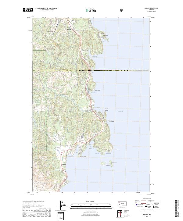
2024 Map of Rollins
USGS Topo · Published 2024About this map
Lakeside and Rollins anchor this topographic view of the western shores of Flathead Lake, where the transition from the high ridges of the Flathead National Forest to the water's edge creates a complex shoreline of inlets and points. The terrain is marked by significant elevations like Mt. Johns and Angel Hill, while the aquatic geography includes numerous distinct bays such as Hockaday Bay, Hughes Bay, and Deweys Bay. Local transport and aviation are represented by the Lakeside Airport and a dense network of residential and mountain roads, including Mabbutt Ranch Rd and Angel Point Rd. Offshore, several named landmasses like Mary B Island, Cedar Island, and Goose Island dot the lake, highlighting the geological complexity of the shoreline. The boundary between Flathead Co and Lake Co bisects the map, reflecting the administrative divisions along this stretch of the waterfront.
Find a feature on this map
112 named features on this map. Tap any name to fly to it.
Don’t see what you’re looking for? This feature index may not catch every label — zoom into the map to look around manually.
Map Details
Editions of this 2024 Rollins Map
This is the sole edition of this map. No revisions or reprints were ever made.
Other maps of this area

1920 · Flathead Lake
USGS Topo · 1:125,000

1943 · Kalispell
USGS Topo · 1:125,000

1956 · Wallace
USGS Topo · 1:250,000

1957 · Kalispell
USGS Topo · 1:250,000

1960 · Kalispell
USGS Topo · 1:250,000

1960 · Wallace
USGS Topo · 1:250,000

1961 · Kalispell
USGS Topo · 1:250,000

1962 · Lion Mountain
USGS Topo · 1:24,000

1962 · Somers
USGS Topo · 1:24,000
1962 · Bigfork
USGS Topo · 1:24,000