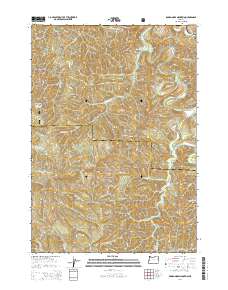
2014 Map of Roman Nose Mountain
USGS Topo · Published 2014About this map
Roman Nose Mountain anchors this high-elevation landscape in the southern reaches of the Siuslaw National Forest, where the headwaters of several major drainage systems converge. The terrain is defined by the complex hydrology of the Siuslaw River and the branching networks of the N Fork Smith River and W Fork Smith River. Human activity is concentrated along narrow forest corridors and the small settlement of Linslaw near the northern boundary, which sits along the Or-126 highway. The map captures a transition in water management and recreation at the Whittaker Cr Recreational Reservoir. Steep, timbered ridges are accessible via a network of service roads such as Kentucky Falls Rd and Dunn Ridge Rd, which provide passage through the dense forest blocks of both Lane and Douglas counties.
Find a feature on this map
35 named features on this map. Tap any name to fly to it.
Don’t see what you’re looking for? This feature index may not catch every label — zoom into the map to look around manually.
Map Details
Editions of this 2014 Roman Nose Mountain Map
This is the sole edition of this map. No revisions or reprints were ever made.
Other maps of this area

1918 · Mapleton
USGS Topo · 1:48,000

1919 · Earl
USGS Topo · 1:48,000

1940 · Mapleton
USGS Topo · 1:62,500

1941 · Blachly
USGS Topo · 1:62,500

1942 · Blachly
USGS Topo · 1:62,500

1942 · Roman Nose Mtn
USGS Topo · 1:62,500

1943 · Goodwin Peak
USGS Topo · 1:62,500

1945 · Mapleton
USGS Topo · 1:62,500

1945 · Roman Nose Mtn
USGS Topo · 1:62,500

1953 · Salem
USGS Topo · 1:250,000