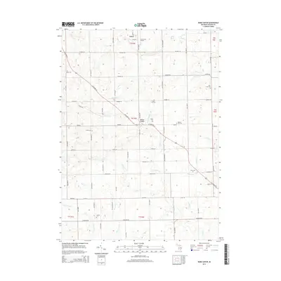
2014 Map of Rome Center
USGS Topo · Published 2014About this map
Onsted anchors the northern edge of this Lenawee County landscape, where the agricultural geometry of southeastern Michigan is intersected by the diagonal path of US Highway 223. This road serves as a primary corridor through Rome Center, linking the region's small hubs and rural homesteads. The terrain is defined by an intricate network of drainage and small waterways, including Wolf Creek and the South Branch River Raisin, which supported the early development of these farming townships.
Find a feature on this map
65 named features on this map. Tap any name to fly to it.
Don’t see what you’re looking for? This feature index may not catch every label — zoom into the map to look around manually.
Map Details
Editions of this 2014 Rome Center Map
This is the sole edition of this map. No revisions or reprints were ever made.
Other maps of this area

1935 · Jackson
USGS Topo · 1:48,000

1939 · Jackson
USGS Topo · 1:62,500

1948 · Manchester
USGS Topo · 1:62,500

1949 · Manchester
USGS Topo · 1:62,500

1953 · Fort Wayne
USGS Topo · 1:250,000

1956 · Fort Wayne
USGS Topo · 1:250,000

1958 · Grand Rapids
USGS Topo · 1:250,000

1961 · Grand Rapids
USGS Topo · 1:250,000

1962 · Grand Rapids
USGS Topo · 1:250,000
1962 · Clayton
USGS Topo · 1:24,000