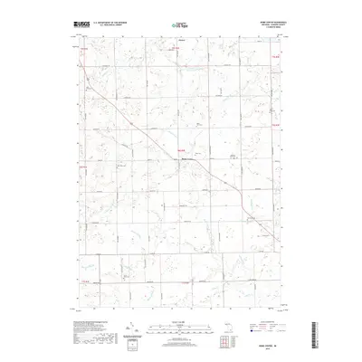
2019 Map of Rome Center
USGS Topo · Published 2019About this map
The settlement of Rome Center and the village of Onsted anchor this Lenawee County landscape, characterized by a complex drainage network that feeds the S Br River Raisin. The area is notably dense with family farm and community burial sites, including the Bates Farm Cem, Halstead Farm Cem, and several geographically named grounds like North Rome Cem and West Rome Cem. These sites, often positioned near local tributaries such as Squaw Cr and Wolf Cr, reflect the deep-rooted agricultural settlement patterns of southern Michigan.
Find a feature on this map
67 named features on this map. Tap any name to fly to it.
Don’t see what you’re looking for? This feature index may not catch every label — zoom into the map to look around manually.
Map Details
Editions of this 2019 Rome Center Map
This is the sole edition of this map. No revisions or reprints were ever made.
Other maps of this area

1935 · Jackson
USGS Topo · 1:48,000

1939 · Jackson
USGS Topo · 1:62,500

1948 · Manchester
USGS Topo · 1:62,500

1949 · Manchester
USGS Topo · 1:62,500

1953 · Fort Wayne
USGS Topo · 1:250,000

1956 · Fort Wayne
USGS Topo · 1:250,000

1958 · Grand Rapids
USGS Topo · 1:250,000

1961 · Grand Rapids
USGS Topo · 1:250,000

1962 · Grand Rapids
USGS Topo · 1:250,000
1962 · Clayton
USGS Topo · 1:24,000