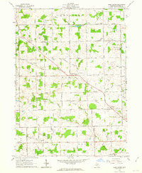
1962 Map of Rome Center
USGS Topo · Published 1964About this map
Rome Center serves as the focal point of this rural Lenawee County landscape, situated at the intersection of Wallace Highway and Rome Road. The area is defined by its agricultural character and a dense network of water management features, including the Shepherd Drain, Fouty Creek, and Atwood Creek, which feed into the larger South Branch River Raisin near the southern boundary. Community life in the early 1960s is anchored by several local institutions, such as the Rome Grange Hall and Four Towns Grange Hall, alongside historic religious sites like North Rome Ch and West Rome Ch. Transportation is facilitated by the New York Central railroad passing through the southeastern corner, while the small Bjorn Landing Strip indicates the presence of private aviation in the post-war era. The numerous cemeteries, including Wolf Creek Cem and East Rome Cem, provide valuable geographic markers for genealogical research in this township-based settlement pattern.
Find a feature on this map
49 named features on this map. Tap any name to fly to it.
Don’t see what you’re looking for? This feature index may not catch every label — zoom into the map to look around manually.
Map Details
Editions of this 1962 Rome Center Map
This is the sole edition of this map. No revisions or reprints were ever made.
Other maps of this area

1935 · Jackson
USGS Topo · 1:48,000

1939 · Jackson
USGS Topo · 1:62,500

1948 · Manchester
USGS Topo · 1:62,500

1949 · Manchester
USGS Topo · 1:62,500

1953 · Fort Wayne
USGS Topo · 1:250,000

1956 · Fort Wayne
USGS Topo · 1:250,000

1958 · Grand Rapids
USGS Topo · 1:250,000

1961 · Grand Rapids
USGS Topo · 1:250,000

1962 · Grand Rapids
USGS Topo · 1:250,000
1962 · Clayton
USGS Topo · 1:24,000