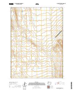
2020 Map of Rome State Airport
USGS Topo · Published 2020About this map
Rome State Airport anchors the northeastern corner of this remote High Desert landscape in Malheur County. The terrain is defined by the Public Land Survey System grids of t34s r38e, t34s r39e, t35s r38e, and t35s r39e, indicating a vast area of open range and complex topography. The map illustrates a high plateau character, where drainage patterns and contour intervals suggest a dry, undulating environment typical of the Owyhee region. This 2020 survey is an essential resource for understanding the modern footprint of infrastructure in one of the most sparsely populated sections of the American West.
Find a feature on this map
5 named features on this map. Tap any name to fly to it.
Don’t see what you’re looking for? This feature index may not catch every label — zoom into the map to look around manually.
Map Details
Editions of this 2020 Rome State Airport Map
This is the sole edition of this map. No revisions or reprints were ever made.
Other maps of this area

1955 · Jordan Valley
USGS Topo · 1:250,000

1955 · Adel
USGS Topo · 1:250,000

1957 · Adel
USGS Topo · 1:250,000

1957 · Jordan Valley
USGS Topo · 1:250,000

1958 · Adel
USGS Topo · 1:250,000

1958 · Jordan Valley
USGS Topo · 1:250,000

1962 · Adel
USGS Topo · 1:250,000

1979 · Anderson Reservoir
USGS Topo · 1:24,000

1979 · Flat Top Mtn SE
USGS Topo · 1:24,000
1980 · Flat Top Mtn
USGS Topo · 1:24,000