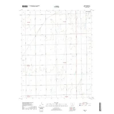
2018 Map of Rome
USGS Topo · Published 2018About this map
Attebery Cem sits centrally within this Sumner County landscape, a marker of early families amidst a dense network of sectional roads and watercourses. The drainage patterns of the region are exceptionally clear, defined by the various branches of Shoo Fly Creek, including W Shoo Fly Cr, Middle Shoo Fly Cr, and E Shoo Fly Cr which flow southward toward the Oklahoma border. To the northeast, the outskirts of Wellington begin to appear near the confluence of Slate Cr and Hargis Cr. The map reveals a strictly organized agricultural grid, with primary north-south arteries like S Maize Rd and S Hoover Rd providing access to the vast acreage between intermittent stream beds like Spring Cr and Antelope Cr. This survey illustrates the enduring intersection of systematic township planning and the natural riparian geography of the southern Kansas plains.
Find a feature on this map
44 named features on this map. Tap any name to fly to it.
Don’t see what you’re looking for? This feature index may not catch every label — zoom into the map to look around manually.
Map Details
Editions of this 2018 Rome Map
This is the sole edition of this map. No revisions or reprints were ever made.
Other maps of this area

1889 · Caldwell
USGS Topo · 1:125,000

1890 · Wellington
USGS Topo · 1:125,000

1893 · Caldwell
USGS Topo · 1:125,000

1897 · Caldwell
USGS Topo · 1:125,000

1955 · Wichita
USGS Topo · 1:250,000

1958 · Wichita
USGS Topo · 1:250,000

1964 · South Haven NE
USGS Topo · 1:24,000

1964 · Dalton
USGS Topo · 1:24,000

1965 · Portland
USGS Topo · 1:24,000

1965 · South Haven
USGS Topo · 1:24,000