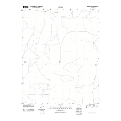
2010 Map of Romero Spring
USGS Topo · Published 2010About this map
Don Carlos Hills dominate the northern landscape of this northeastern New Mexico plateau, where the open terrain is defined by a network of rural roads and sparse settlements. The small community of Gard sits in the southwestern portion of the map, connected by local routes such as County Rd-C011. This 2010 survey reflects a period where the high plains infrastructure remained centered on ranching and regional transit, with large-scale land divisions visible across the high country. Major transportation corridors, including the shared path of Highway 56 412, bisect the center of the quadrangle, while County Hwy C-015 serves as a primary north-south artery for this corner of Union County.
Find a feature on this map
6 named features on this map. Tap any name to fly to it.
Don’t see what you’re looking for? This feature index may not catch every label — zoom into the map to look around manually.
Map Details
Editions of this 2010 Romero Spring Map
This is the sole edition of this map. No revisions or reprints were ever made.
Other maps of this area

1954 · Dalhart
USGS Topo · 1:250,000

1958 · Dalhart
USGS Topo · 1:250,000

1962 · Dalhart
USGS Topo · 1:250,000

1973 · Gladstone NW
USGS Topo · 1:24,000

1973 · Tripod Mountain
USGS Topo · 1:24,000

1973 · Beenham
USGS Topo · 1:24,000

1973 · Sofia
USGS Topo · 1:24,000

1973 · Romero Spring
USGS Topo · 1:24,000
1973 · Pennington
USGS Topo · 1:24,000
1977 · Aragon Hill
USGS Topo · 1:24,000