
1973 Map of Sofia
USGS Topo · Published 1978About this map
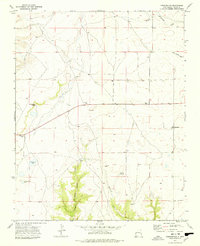
Sante Fe Trail (Cimarron Cutoff) traces a historic westward path across the high plains of Union County in this early 1970s survey. The landscape is defined by the transition from the broad drainages of Cedar Creek and Gallegos in the north to the rising elevations of the Don Carlos Hills in the southwest. This era captures the remains of earlier transportation infrastructure, most notably the Old Railroad Grade that runs east-to-west through the small settlement of Sofia. The placement of the Sofia Cem near this corridor provides a specific point of interest for genealogists tracing families in this part of northeastern New Mexico. The map also records localized industrial activity, such as a Gravel Pit south of the main settlement, amid a landscape otherwise characterized by expansive grazing lands and a network of rural fence lines.
Find a feature on this map
8 named features on this map. Tap any name to fly to it.
Don’t see what you’re looking for? This feature index may not catch every label — zoom into the map to look around manually.
Map Details
Editions of this 1973 Sofia Map
This is the sole edition of this map. No revisions or reprints were ever made.
Other maps of this area

1954 · Dalhart
USGS Topo · 1:250,000

1958 · Dalhart
USGS Topo · 1:250,000

1962 · Dalhart
USGS Topo · 1:250,000

1972 · Malpie Mountain
USGS Topo · 1:24,000

1972 · Cow Mountain
USGS Topo · 1:24,000

1973 · Gladstone NW
USGS Topo · 1:24,000

1973 · Grenville SW
USGS Topo · 1:24,000

1973 · Tripod Mountain
USGS Topo · 1:24,000

1973 · Romero Spring
USGS Topo · 1:24,000
1973 · Pennington
USGS Topo · 1:24,000