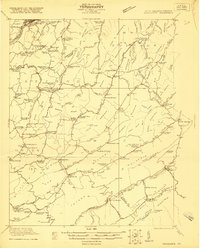
1921 Map of Ronceverte
USGS Topo · Published 1921About this map
Organ Cave stands as a subterranean landmark in this rugged corner of the Greenbrier and Monroe County borderlands. Surveyed in the early 1920s, the landscape is defined by the steep ridges of Peters Mountain and Kates Mountain, where small farming and milling communities gathered at the gaps and springs. The map documents an era when one-room schoolhouses like Horseshoe Bend School and Schley School were the centers of rural life, and mineral-rich waters drew visitors to Sweet Springs and Crimson Springs.
Find a feature on this map
128 named features on this map. Tap any name to fly to it.
Don’t see what you’re looking for? This feature index may not catch every label — zoom into the map to look around manually.
Map Details
Editions of this 1921 Ronceverte Map
2 editions found

Other maps of this area

1887 · Hinton
USGS Topo · 1:125,000

1887 · Lewisburg
USGS Topo · 1:125,000

1890 · Dublin
USGS Topo · 1:125,000

1890 · Christiansburg
USGS Topo · 1:125,000

1891 · Lewisburg
USGS Topo · 1:125,000

1891 · Dublin
USGS Topo · 1:125,000

1892 · Hinton
USGS Topo · 1:125,000

1921 · Callaghan
USGS Topo · 1:48,000

1921 · Alderson
USGS Topo · 1:48,000

1921 · White Sulphur Springs
USGS Topo · 1:48,000