
1921 Map of Ronceverte
USGS Topo · Published 1921About this map
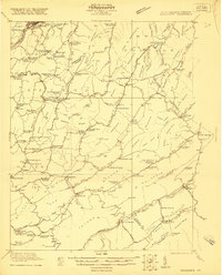
Peters Mountain and the towering ridges of the Allegheny Front dominate this early 1920s topography of the West Virginia and Virginia border. The landscape is defined by its deep karst geology, most notably at Organ Cave near the settlement of Organ Cave. The map records a dense network of early 20th-century rural life, where community identity centered on local institutions like Elizabeth Chapel, Crimson Springs Church, and the Schley School.
Find a feature on this map
83 named features on this map. Tap any name to fly to it.
Don’t see what you’re looking for? This feature index may not catch every label — zoom into the map to look around manually.
Map Details
Editions of this 1921 Ronceverte Map
2 editions found
Other maps of this area

1887 · Hinton
USGS Topo · 1:125,000

1887 · Lewisburg
USGS Topo · 1:125,000

1890 · Dublin
USGS Topo · 1:125,000

1890 · Christiansburg
USGS Topo · 1:125,000

1891 · Lewisburg
USGS Topo · 1:125,000

1891 · Dublin
USGS Topo · 1:125,000

1892 · Hinton
USGS Topo · 1:125,000

1921 · Callaghan
USGS Topo · 1:48,000

1921 · Alderson
USGS Topo · 1:48,000

1921 · White Sulphur Springs
USGS Topo · 1:48,000