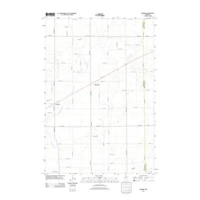
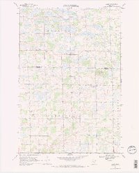
2013 Map of Ronneby
USGS Topo · Published 2013About this map
The Saint Francis River and its western tributary, the W Br Saint Francis River, define the low-lying geography of this Benton County landscape. In the early 21st century, the area remains primarily agricultural, anchored by the small settlements of Ronneby and Oak Park. The grid of county roads is punctuated by several local landmarks of genealogical interest, including Riverside Cem near the riverbanks and Maywood Cem further south. The MN-23 corridor cuts diagonally through the townships, serving as the primary transit link between these rural communities. To the southeast, Hanenburg Farms and the winding course of Estes Brook illustrate the transition toward the Mille Lacs County border, while the presence of School House Rd Ne points to the locations of former local rural school districts.
Find a feature on this map
51 named features on this map. Tap any name to fly to it.
Don’t see what you’re looking for? This feature index may not catch every label — zoom into the map to look around manually.
Map Details
Editions of this 2013 Ronneby Map
This is the sole edition of this map. No revisions or reprints were ever made.
Other maps of this area

1953 · Stillwater
USGS Topo · 1:250,000

1955 · Stillwater
USGS Topo · 1:250,000

1958 · Stillwater
USGS Topo · 1:250,000

1965 · Stillwater
USGS Topo · 1:250,000
1968 · Foley
USGS Topo · 1:24,000

1968 · Rum River
USGS Topo · 1:24,000
1968 · Santiago
USGS Topo · 1:24,000
1968 · Princeton SW
USGS Topo · 1:24,000
1968 · Ramey
USGS Topo · 1:24,000

1968 · Milaca
USGS Topo · 1:24,000