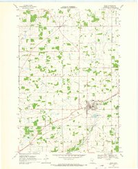
1968 Map of Foley
USGS Topo · Published 1970About this map
Foley serves as the central hub of this late 1960s survey, showing the community's layout at the junction of the Great Northern railroad and regional roadways. The landscape is a mix of agricultural plots and drainage systems, with the Elk River winding through the northern sections near Jakeville and Gilman. Local civic life is anchored by features like the Foley Sch, the St Johns Cem, and a Townhall located further north in Gilmanton township.
Find a feature on this map
21 named features on this map. Tap any name to fly to it.
Don’t see what you’re looking for? This feature index may not catch every label — zoom into the map to look around manually.
Map Details
Editions of this 1968 Foley Map
2 editions found
Other maps of this area

1948 · Pierz
USGS Topo · 1:62,500

1950 · Pierz
USGS Topo · 1:62,500

1950 · St. Cloud
USGS Topo · 1:62,500

1953 · Saint Cloud
USGS Topo · 1:250,000

1953 · Stillwater
USGS Topo · 1:250,000

1955 · Stillwater
USGS Topo · 1:250,000

1957 · Saint Cloud
USGS Topo · 1:250,000

1958 · Stillwater
USGS Topo · 1:250,000

1958 · Saint Cloud
USGS Topo · 1:250,000

1965 · Stillwater
USGS Topo · 1:250,000