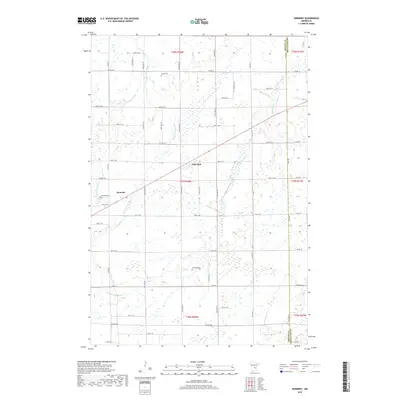
2019 Map of Ronneby
USGS Topo · Published 2019About this map
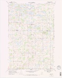
Saint Francis River winds through the central and western reaches of this landscape, its path defining a low-lying terrain marked by numerous wetlands. Small agrarian settlements and burial grounds are scattered throughout the region, including the crossroads of Ronneby and the community of Oak Park. These locales are connected by a network of rural roads such as Co HWY 6 and Co HWY 5, which cut through the township divisions of T37N and T38N. Several family and community resting places, such as Riverside Cem, Elwell Cem, and Maywood Cem, provide vital touchstones for genealogical research. The eastern border is clearly defined by the Benton Co and Mille Lacs Co line, where Estes Brook flows through the northeast corner, illustrating the local drainage patterns that shaped the early development of these central Minnesota townships.
Find a feature on this map
52 named features on this map. Tap any name to fly to it.
Don’t see what you’re looking for? This feature index may not catch every label — zoom into the map to look around manually.
Map Details
Editions of this 2019 Ronneby Map
This is the sole edition of this map. No revisions or reprints were ever made.
Other maps of this area

1953 · Stillwater
USGS Topo · 1:250,000

1955 · Stillwater
USGS Topo · 1:250,000

1958 · Stillwater
USGS Topo · 1:250,000

1965 · Stillwater
USGS Topo · 1:250,000
1968 · Foley
USGS Topo · 1:24,000

1968 · Rum River
USGS Topo · 1:24,000
1968 · Santiago
USGS Topo · 1:24,000
1968 · Princeton SW
USGS Topo · 1:24,000
1968 · Ramey
USGS Topo · 1:24,000

1968 · Milaca
USGS Topo · 1:24,000