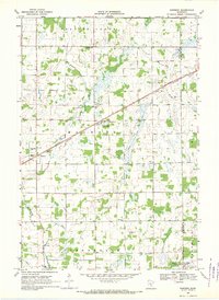
1968 Map of Ronneby
USGS Topo · Published 1970About this map
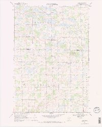
The Great Northern railroad cuts a diagonal line across this 1960s landscape, anchoring the central Minnesota communities of Ronneby, Oak Park, and Maywood. This survey reveals a transition from the structured township divisions of Granite Ledge and Milo to the more organic drainage patterns formed by the St Francis River and its West Branch. The presence of several rural educational and religious landmarks, such as School No 101 and Maywood Ch, highlights the decentralized nature of local society at the time.
Find a feature on this map
28 named features on this map. Tap any name to fly to it.
Don’t see what you’re looking for? This feature index may not catch every label — zoom into the map to look around manually.
Map Details
Editions of this 1968 Ronneby Map
This is the sole edition of this map. No revisions or reprints were ever made.
Other maps of this area

1953 · Stillwater
USGS Topo · 1:250,000

1955 · Stillwater
USGS Topo · 1:250,000

1958 · Stillwater
USGS Topo · 1:250,000

1965 · Stillwater
USGS Topo · 1:250,000
1968 · Foley
USGS Topo · 1:24,000

1968 · Rum River
USGS Topo · 1:24,000
1968 · Santiago
USGS Topo · 1:24,000
1968 · Princeton SW
USGS Topo · 1:24,000
1968 · Ramey
USGS Topo · 1:24,000

1968 · Milaca
USGS Topo · 1:24,000